Danny Jalbout started Atlanta, Georgia's Hot Wing Drones—an aerial mapping company serving the agriculture, real estate, construction, insurance, and other industries—with a vision that automation technology would be as standard as the cell phone. The company's primary mission is to improve the world by contributing to its future.
During his time as an electro-mechanic, Jalbout saw several industries getting older and a labor market getting smaller. In fact, Fortune.com reported that studies show we may have 85 million unfilled jobs globally due to skills shortages by 2030.
So, in the same way that companies embrace new policies to attract talent, they also will have to implement new technologies to prevent their employees from being overworked and bogged down on tasks outside of their specialty.
Hot Wing Drones wants to be that relief point with specialized drones and pilots that know how to get the most out of their equipment. Hot Wing Drones takes care of the administrative paperwork and flying (permissions required to pass, maintenance of the aircraft, using software, and evolving laws), so that companies and their employees can focus on the job.
Everything that is built needs to be inspected throughout the life of the infrastructure, and there is no point in wasting valuable resources on these tasks. Drones are faster and more accurate than humans, helping to build a safer and more efficient future.
Part of Hot Wing Drones’ mission for a better future includes preparing a generation of young adults ready for tomorrow’s technology. Hot Wing Drones is committed to providing scholarships to marginalized students going into STEM (Science, Technology, Engineering, Mathematics) and trade fields.
Drone technology is still in its beginning stages, but every day, companies push what is possible. Their uses make companies more efficient and produce data that was once too expensive for everyday use.
The Future of Thermal Inspections
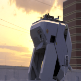
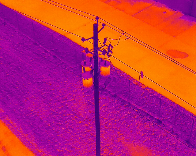
Drones are reaching new heights every day, and companies are pushing what is possible—such as with DJI's Matrice 300 drone. As technology in the UAVs sector grows, companies will implement them in everyday cases. One primary use is inspections. Not only can a drone perform a visual inspection, but it can do thermal ones—often at the same time with live feedback. These inspections can catch things that might be missed because of the ability of a drone to see the structure from angles not possible by humans.
Drones with thermal cameras can achieve radiometric data. This is when each pixel captures temperature data to make it easier to compare the same objects. During post-analysis, a person can click on any part of the image and get instant information on its temperature—such as comparing transformers in the field to see if there are significant variations.
Aerial thermal images can spot objects on the ground, even if there is vegetation. Farmers and conservations use thermal drones to keep track of livestock, and with the added ability to cover large areas at once.
Drones save time. Solar farms are some of the current users. One study showed that a drone could do a 5MW solar farm—typically about 30 to 40 acres—in one hour, while a ground crew would more than 100 hours.
The best part is that many drones, such as the DJI Zenmuse H20T can now take both aerial photos and thermal photos at the same time. This gives people the ability to compare photos—on a roof you can see if there is a leak or vent—reducing the rate of false positives, giving the consumer a better picture of their system, and diminishing wasted resources.
Drones help save money by finding problems that the eyes can’t see. Thermal roof inspections can see water, energy leaks, and any physical damage to the structure. There are no extra safety precautions needed with drones. For example, there's no reason to send a crew member to inspect a power-line pole, because the drone can capture the same data as someone climbing up a pole. Also, 80 percent of inspections show nothing is wrong with the infrastructure. This is a significant waste of a crew's time when they can be focusing on another task. Instead of sending a tech to each site, send in a drone team to do the groundwork while the experts can stay in a central location and analyze the data with the same information as if they were there. In addition, aerial inspections help workers avoid hazardous environments, and stay away from private property, aggressive dogs, volatile homeowners, and areas that are not well maintained.
3-D rendering
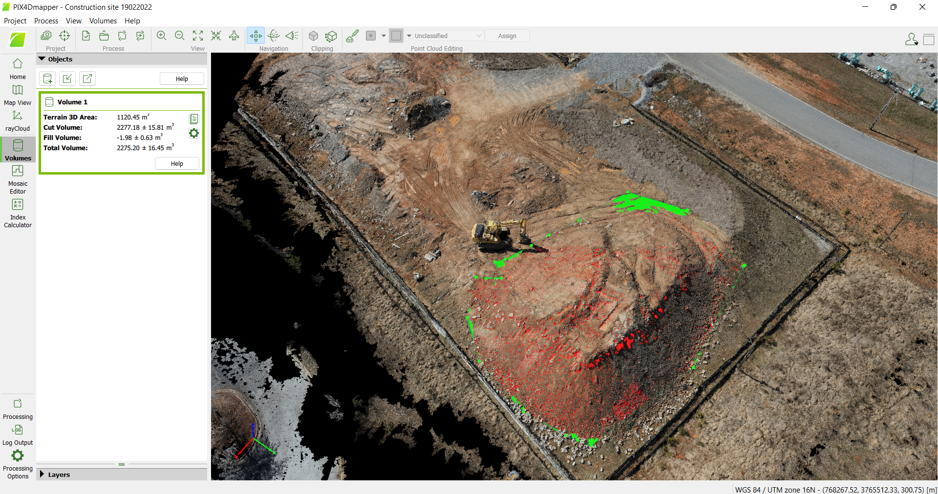
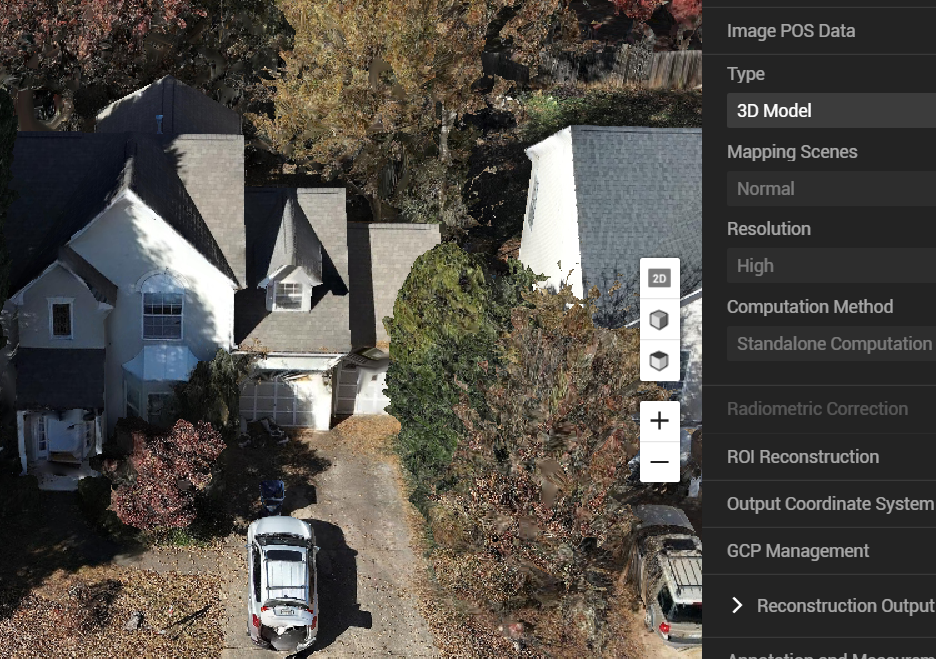
Three-dimensional rendering uses the concept of photogrammetry, which takes aerial images at different angles on a set flight plan. The photos are processed, creating a 3-D or 2-D model. The outputs are highly detailed and are exact reconstructions of the object. The models help with critical assessments such as pre-site planning and stockpile-volume measurement inspections, and more uses are being added every day.
The measurements can reach sub 5cm accuracy and are compatible with most CAD software. Even when a company doesn't have access to the right software, a detailed report can be made. One person can analyze the data from his or her desk, and get the same results as being on the field.
Experts can use this data to determine post-disaster damage, saving a trip to the site. Teams use models to ensure their project goes according to plan, and these results are shared with the entire team to keep everyone on the same page. The process saves time and is more efficient for the customer. One 40-minute flight captures more data (about 200 acres in one flight) than what took weeks using traditional methods. The process is more accurate than humans, and the same job is repeatable with AI.
Accessibility is no longer a question, as drones can go into areas that are difficult to reach or hazardous to people. Drones can cover areas with high vegetation or high hills. Three-dimensional rendering is an advantage for any company, as it provides a fast and safe way to give teams a complete picture of what is happening on the field.