
26 September 2025
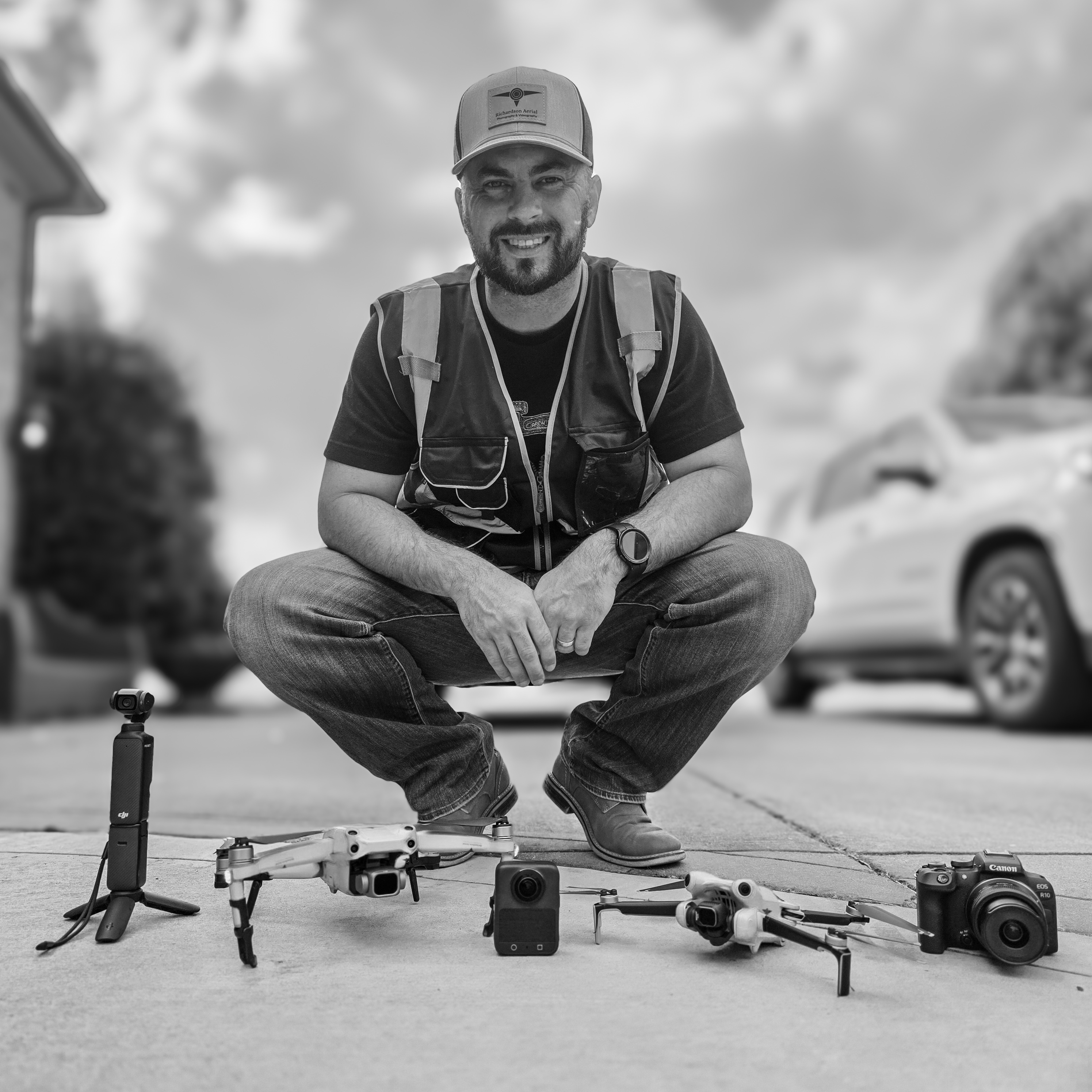
When Richardson Aerial was launched, the innovativion was driven by more than just a love for photography and aviation. With a professional background in data and analytics, we have a deeper appreciation for how information can drive smarter decisions. Quickly realizing that drones weren’t just about stunning visuals—they were also about capturing, analyzing, and delivering valuable data.
Before stepping into the drone industry, my professional background is in data and analytics. My career revolves around turning raw numbers into meaningful insights—helping organizations understand patterns, make informed choices, and operate more effectively.
That background shaped the way I approach drone work today. Not just see drones as flying camera, I see them as data collection tools that can gather aerial images, maps, and 3D models, which can then be analyzed to guide real-world decisions.
With a passion for photography and aviation, photography gave me an artistic outlet, while aviation sparked my curiosity about seeing the world from new perspectives. When drones became more accessible, I knew I had found the perfect way to bring all three passions together—data, creativity, and flight.
Richardson Aerial
Richardson Aerial was established because of a desire to give people and businesses a new way to see the world—not just visually, but analytically. Traditional photography and videography are powerful, but they stop at the surface. Drones go beyond that, capturing data that can be turned into insights for real estate, construction, land development, inspections, and more.
The content needed for these industries needs to be obtainable and accessible for other businesses without impacting their profits margines. With the proper equipment, aerial content is now an asset that has the ability to increase their profit margins. Aerial footage and data collection use to require helicopters, planes, or expensive crews. With drones, the same product can be delivered with the same level of quality (and most of the time better) at a fraction of the cost. That accessibility has opened doors for real estate agents, small businesses, developers, and individuals who want professional-grade aerial services without breaking the bank.
Services Provided
At Richardson Aerial, we offer a wide range of services that combine creative and analytical skills to develop the ideal result for your particular needs:
Aerial Photography & Videography
Capturing stunning visuals remains at the core of what I do. From marketing videos to real estate listings and event coverage, I aim to deliver imagery that tells stories and makes a lasting impression.
Real Estate Marketing
Working with agents to showcase properties in ways that highlight their layout, surroundings, and unique features. Drone visuals provide a sense of scale and perspective that traditional photos can’t match.
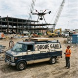
Construction Monitoring
For developers and contractors, I provide progress updates and aerial documentation. With my analytics background, I can present this information in structured ways that help stakeholders make decisions faster and more effectively.
Inspections and Mapping
This is where my data experience shines. I use drones to gather high-resolution imagery and data for inspections, roof assessments, land surveys, and 3D modeling. The value isn’t just in the visuals—it’s in the actionable information clients gain.
Custom Projects
I enjoy tackling unique challenges, whether that’s creating cinematic footage, building 3D maps, or developing customized data-driven aerial reports. The flexibility of drone technology means every project can be tailored to specific client needs.
Jobs Completed
Over the years, we’ve worked on projects that highlight both the creative and technical sides of drone services:
Ortho Photogrammetry: Orthophotos are created by stitching hundreds to thousands of pictures together to create a more detailed, aerial view. These images can be used for land surveying with property line mapping or or gaining a better detailed aerial perspective. The orthophotos can show plant health and different areas of forest growth, highlighting certain features of the terrain and the lot itself.
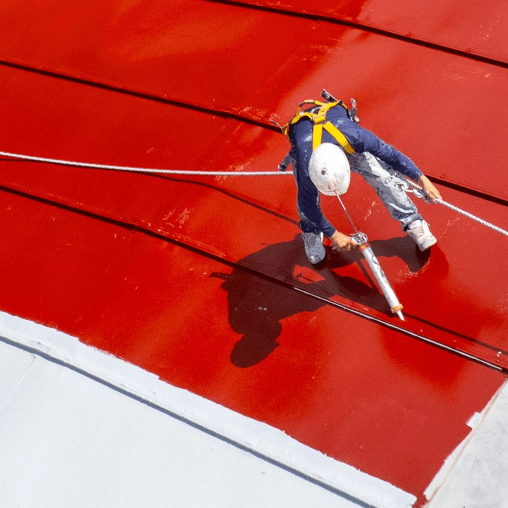
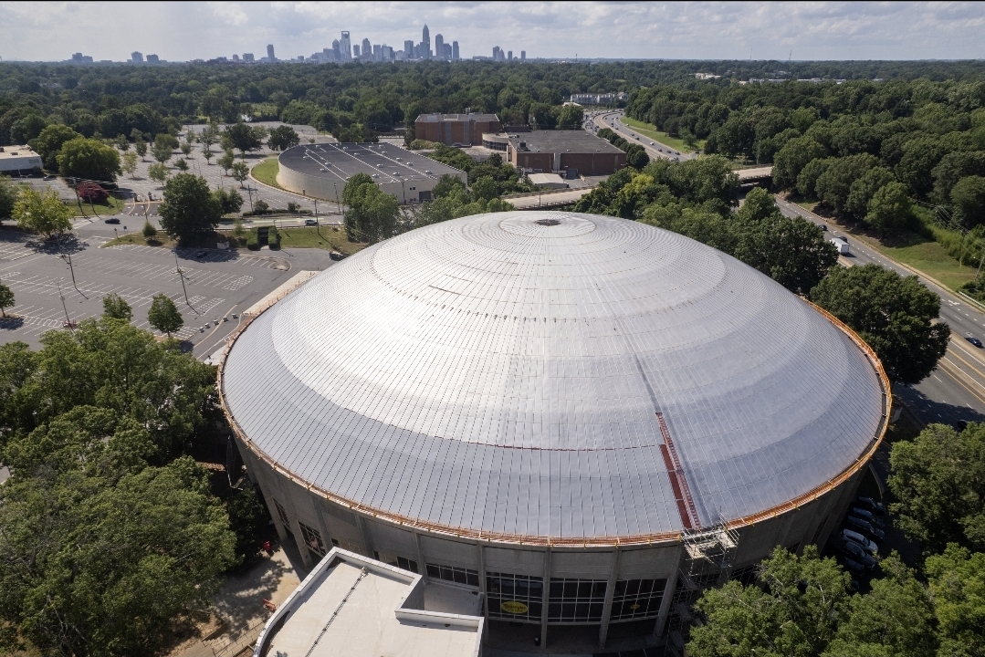
Roofing and Inspections: While contracted with a local roofing company, we were able to provide them with the aerial content they needed to increase bids and add marketing materials to reach new clients. The aerial content is delivered with high detail that highlights the whole phase of the project. Our operators capture the before images of the roof, highlighting areas of need that isn’t easily visible from a person standing on the roof. Returning several times during the roofing process, the operators highlights the work being performed, while keeping the image clean and presentable. Final aerial content is captured for the end results, creating content that highlights the whole project, not just one part of it.
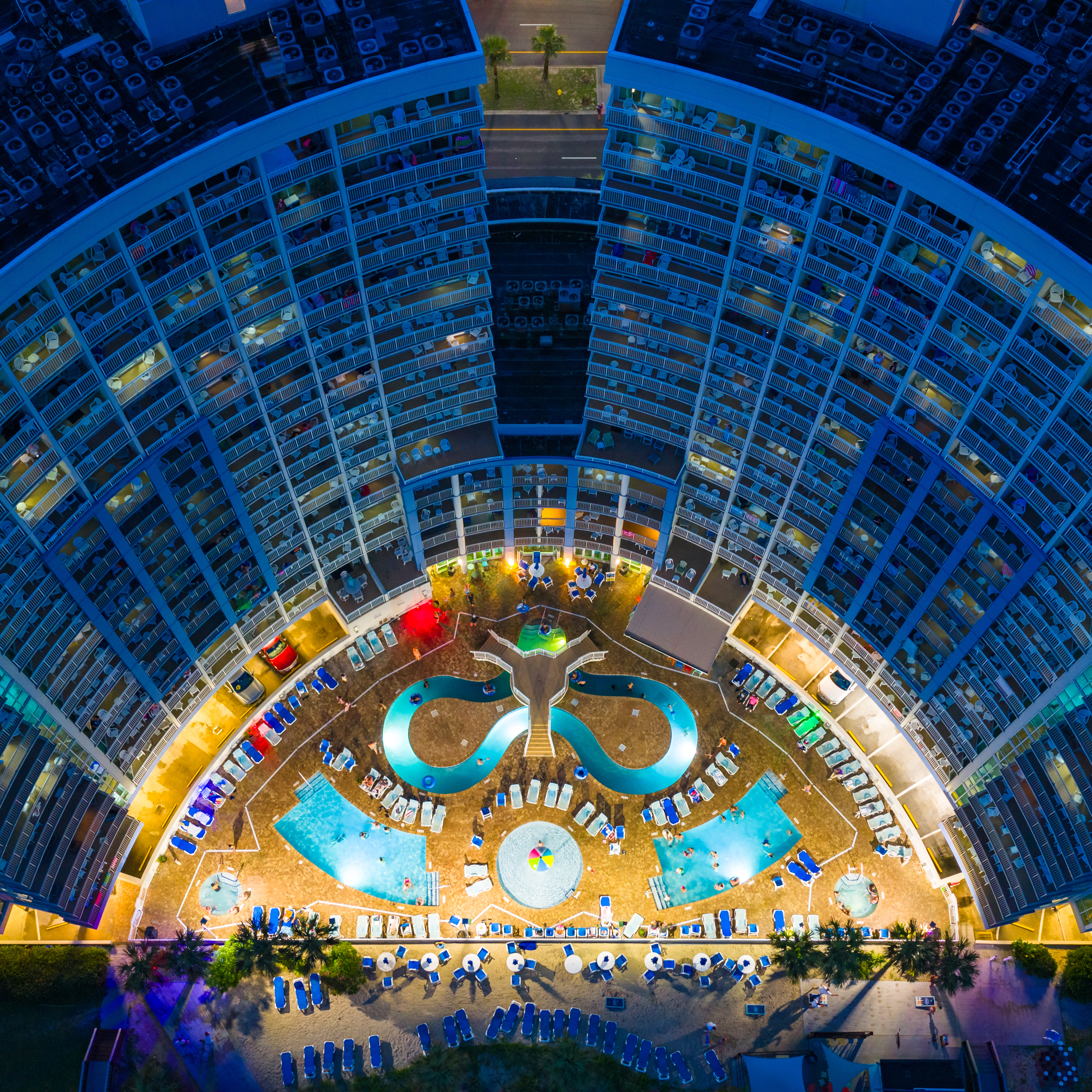
Real Estate Footage: Delivering exterior aerial footage that helps rental properties highlights the house, lot, features of the surrounding area by giving Airbnb owners marketing materials so that they can give potiental renters a better understanding of properties.
Construction Updates: Providing regular aerial reports that gave contractors a clear, data-backed view of progress.
Aerial Inspections: From Billbaords to Pier inspections, our equipment is capable of capturing the image of a single bolt and the position of the bolt. Never miss any ofnthe detail. These inspections are delivered in video and photographs, highlighting particular areas of interest.
360 photos, Hyperlapes, Dolly Zoom, and Other Unique Shots: Every project has a different need and our operators are able to capture all of the professional footage to help your business grow and meet the needs of your clients.
The Economic Benefits of Drones
Drones are creating massive economic benefits for clients, industries, and entrepreneurs like me. With my analytics mindset, I often think in terms of efficiency, cost savings, and ROI, and drones deliver on all three.
Lower Costs: Aerial imaging and surveys that once required helicopters or planes can now be done with a drone at a fraction of the price.
Efficiency: Drones complete tasks in hours that might take days on the ground. For example, mapping large plots of land or inspecting hard-to-reach structures can be done quickly and accurately.
Safety: By handling risky inspections from the air, drones keep workers safe and reduce liability for businesses.
Competitive Edge: Companies that embrace drones stand out, offering modern, tech-driven solutions that appeal to today’s clients.
For me personally, drones have provided a way to merge my data background with my entrepreneurial goals, creating a business that brings both creativity and analytical value to the table.
The Future of Drones
The future of drones lies not just in better cameras, but in smarter data.
Broader Industry Adoption: Sectors like agriculture, logistics, public safety, and environmental monitoring are still just scratching the surface of what drones can do.
AI and Autonomy: Future drones will use artificial intelligence to analyze data on the fly, making them more autonomous and capable of delivering instant insights.
Drone Deliveries: Companies like Amazon and UPS are already testing delivery systems, and we’re likely to see drones become part of everyday logistics.
Environmental Applications: From monitoring ecosystems to aiding disaster relief, drones will play a bigger role in sustainability and conservation.
At Richardson Aerial, my focus is providing quality and professional content that will help my clients grow their business. With my background in analytics, we will continue expanding into data-driven drone services that doesn't just capture visuals but deliver actionable intelligence to my clients.
Starting Richardson Aerial has allowed me to bring together three passions—data, creativity, and aviation—into one business. My analytics background gives me a unique edge in understanding how drones can be used not just for imagery, but also for insights and decision-making.
Whether I’m capturing a home for sale, documenting a construction project, or mapping land for development, my mission is the same: to provide professional, innovative drone services that add real value for my clients.
The drone industry is growing quickly, and I’m excited to be part of it. For me, Richardson Aerial isn’t just about flying drones—it’s about helping people see the bigger picture, both visually and strategically.
Learn More About Richardson Aerial